
By Vanessa Kichline
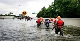
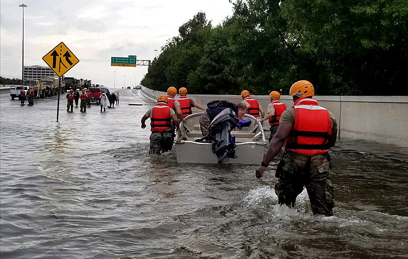
This year’s hurricane season has been one of the worst on record. We’ve already seen two Category 5 hurricanes make landfall in the United States, wreaking havoc to the tune of some $200 billion in damages—and the season isn’t over yet.
Dr. Michael Neuman, professor and award-winning researcher of sustainable urbanism, joined Bard CEP’s National Climate Seminar to discuss methods for understanding and minimizing the destruction of the storms that seem to constantly ravage the Atlantic coast. (Hear his complete talk here.)
Why are these storms so destructive?
Climate change is a major culprit, according to scientists, but that’s not the whole story. It’s too early to say whether climate change has made a measurable impact on hurricane frequency or intensity, but rising temperatures are likely to increase storm activity over the course of the century. Warmer oceans will also lead to sea level rise, inundating coastal wetlands and making storm surges even more devastating.
However, climate change isn’t the only way that human activity can amplify the effects of major hurricanes. In his National Climate Seminar discussion, Neuman outlined the impacts of urban development on storm outcomes and what we can do to reduce our national risk.
Weathering a New Century of Storms
There are three basic strategies available to officials who are facing down future storms: Mitigate, Adapt, or Retreat. We can fight hurricanes by improving building codes and evacuation plans, or we can give up on high-risk areas and move urban areas out of likely hurricane paths. Both strategies have their merits, but neither is an appropriate solution across the entire Gulf Coast. Using examples from two of his recent projects, Dr. Neuman gave us a look inside the decision-making process.
Risk in the Heart of Texas
Risk assessment is invaluable tool for developers planning major urban projects, such as the recently announced Hyperloop high-speed rail route through the Texas Urban Triangle. This region is already home to over 20 million people and contains five of the top eight fastest-growing cities. But, as Hurricane Harvey so brutally reminded us, the region is also at risk. Developers need to know where it’s safe to build.
Neuman and his team turned their focus to Texas, researching the complexities of storm risk in the region. Their analysis revealed something startling just beneath the surface.
Houston is build on sandy soils with groundwater close to the surface. Declining levels of groundwater are causing the city to literally sink. What’s worse is that in this sinking city, buried waste doesn’t stay buried for long. Houston is home to a large number of hazardous waste sites, positioned in highly populated, high flood risk areas. The EPA has already taken note of the health risk that contaminated floodwaters can pose.
Neuman says that these toxic waste sites are a prime example for employing the three storm strategies:
- Mitigate: If we don’t produce toxic waste, we don’t need to dump it. This is easier said than done, however—as Neuman says, “We all have about twenty different hazardous chemicals in our homes right now.”
- Adapt: We can adapt landfill design to make them less permeable to stormwater, adapt cities so that they aren’t so affected by waste sites, or adapt the environment between dumps and cities to create better buffers.
- Retreat: Neuman says it’s a terrible idea to have these hazardous waste sites so close to population centers. While it wouldn’t be easy, we could consider moving the dump away from the city…or vice versa.
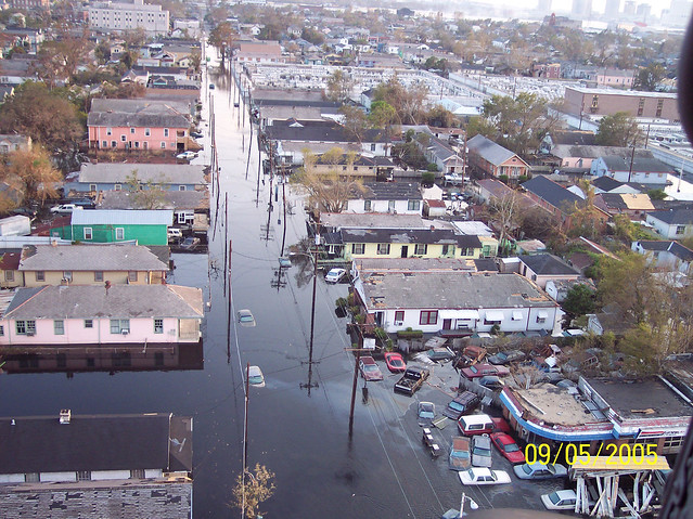
Lessons from Louisiana
It’s no secret that Louisiana’s Gulf Coast has been hit hard by hurricanes in recent years. Breached levees are blamed for Katrina’s historically high death toll and economic damages, but there’s more to it than that. Neuman and his team examined a few lesser-known factors, including social, economic, and ecological vulnerability. Let’s zoom in on two aspects of ecological vulnerability.
Barrier island erosion: The Louisiana Coast was protected for many years by an intricate network of wetlands and barrier islands. In the twentieth century, Army Corps of Engineers projects channeled rivers in Louisiana, transforming webs of meandering streams into large shipping canals. Fresh water that once slowly supplied barrier islands with new sediment now barrels into the gulf. Combined with rising sea levels, the result is the severe erosion of these important islands.
Wetland loss: Urban development and Army Corps projects have filled in and built over many coastal wetlands, replacing them with ineffective concrete levees. Today, the remaining wetlands are crisscrossed by pipelines that carry oil from the Gulf. Nearly 20,000 miles of pipeline break through the wetlands. According to Neuman, about 2.5 miles of wetland area are required to buffer one foot of storm surge. Without the recent wetland degradation, even Katrina’s record-breaking storm surge could have been buffered.
This is only one of many layers on the region’s vulnerability map. Neuman and his team worked across disciplines and geographic scales to synthesize local knowledge, scientific research, and global context into a workable map that shows where sustainable growth is feasible, and where the risk is just too high: where we can adapt, and where we must retreat.
There are too many disastrous storms in our national memory to not act. Clear, in-depth risk assessments like those Neuman and his team compiled can give us the baseline knowledge we need to create a sustainable, resilient Atlantic Coast.